Ascension Island’s Mesophotic Ecosystems
Exploring the Deep: Uncovering Ascension Island’s Mesophotic Ecosystems
Beneath the clear blue waters of Ascension Island lies a vast and largely unexplored world. While the island’s shallow reefs are relatively well studied, the ecosystems beyond diver depths — known as the mesophotic zone (approximately 30–300 m) — remain one of the biggest knowledge gaps within the Marine Protected Area (MPA).
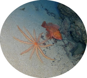
Covering more than 99% of the MPA, these deeper habitats are critical to understanding how Ascension’s marine ecosystem functions as a whole. Yet until recently, very little was known about the species, habitats, and ecological processes occurring at these depths.
Why the Mesophotic Zone Matters
Mesophotic ecosystems play a vital role in supporting marine life. They are thought to sustain important stages in the life cycles of fish species, including those important to local fisheries, and may act as refuges from environmental change.
There is also growing evidence that these deeper habitats may host coral communities and other organisms that contribute to carbon storage, making them important in the context of climate change mitigation. However, without detailed data on their distribution and composition, it has not been possible to quantify these benefits or assess their vulnerability.
Understanding these ecosystems is therefore essential for effective, evidence-based management of the MPA.
The Darwin Plus Mesophotic Project

To address this gap, the project “Building baseline knowledge of mesophotic ecosystems in Ascension Island MPA” (DPLUS213) is currently underway. Led by Plymouth Marine Laboratory in partnership with the Ascension Island Government, the project runs from 2024 to 2026 and focuses on collecting the first comprehensive dataset from these depths.
The project combines biological surveys, oceanographic data collection, and habitat mapping to build a clearer picture of the mesophotic environment. These data will be used to improve fisheries management, support assessments of carbon sequestration, and ensure that climate-driven changes can be incorporated into future management plans.
 How Are We Exploring the Deep
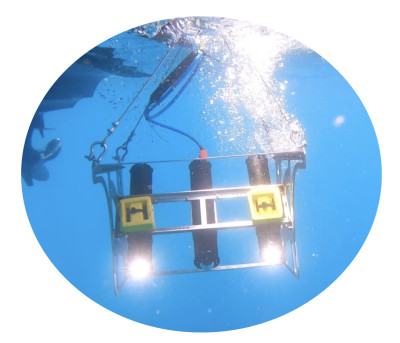
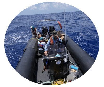
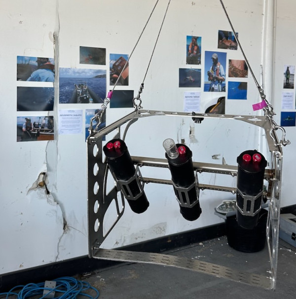
Studying the mesophotic zone presents significant logistical challenges, but advances in marine technology are making this work increasingly possible. Using drop-down and tethered camera systems deployed from small research vessels, teams are able to capture imagery of the seafloor and associated marine life at depths well beyond traditional scuba limits.
Initial surveys have already revealed diverse and previously undocumented habitats, including deep coral communities and complex reef structures. These early findings highlight just how much remains to be discovered beneath Ascension’s waters.
Building Local Capacity
A key component of the project is training and capacity building. Fieldwork has been carried out in close collaboration with the Ascension Island Government Conservation and Fisheries Directorate, with a strong focus on developing the skills and protocols needed for long-term, on-island monitoring.
By the end of the project, our teams will be fully equipped to continue mesophotic surveys independently, ensuring that data collection can continue well into the future.
Informing the Future of the MPA
The mesophotic project directly supports the priorities set out in the Ascension Island MPA Management Plan and Monitoring, Evaluation and Research Strategy, where deep-sea ecosystems have been identified as a critical research gap.
By filling this gap, the project will enable more robust, ecosystem-scale management of the MPA. It will also contribute to broader conservation goals, including biodiversity protection, sustainable fisheries, and climate resilience.
Key Findings and Project Outputs
Now the project is in it’s final stages it has transformed our understanding of Ascension’s marine environment. Each deployment into deeper waters reveals new species, habitats, and insights into how the ecosystem functions.
The project has delivered some of the first detailed information on the deeper marine habitats surrounding Ascension Island. These outputs provide an essential evidence base for the long-term management and conservation of the Ascension Island Marine Protected Area (MPA).
Mapping Ascension’s Hidden Habitats
One of the most significant achievements of the project has been the production of the first habitat maps for Ascension’s mesophotic zone. By combining underwater imagery, seabed mapping and oceanographic information, the project has identified and characterised a diverse range of habitats occurring between approximately 30 and 250 meters depth.
These maps reveal the distribution of rocky reef, black coral habitats, rhodolith beds and extensive sea pen habitats, providing an understanding of how biodiversity is distributed beneath the ocean surface. This baseline information is critical for monitoring environmental change, assessing the impacts of climate change and supporting ecosystem-based management of the MPA.
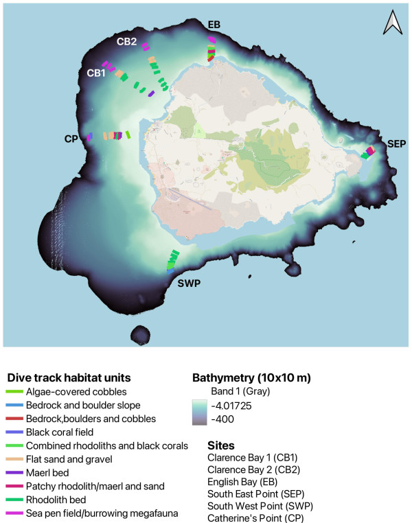
Figure 1. Whole island overview habitat map showing the distribution of mesophotic habitats around Ascension Island.
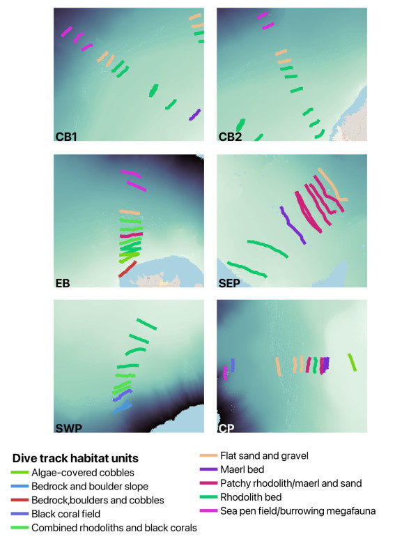
Figure 2. Mesophotic survey transects showing finer scale habitat distribution around Ascension Island.
Discovery and Mapping of Rhodolith Beds
The project has also identified and mapped previously undocumented rhodolith beds around Ascension Island. Rhodoliths are free-living nodules of coralline algae that create structurally complex habitats supporting a wide variety of marine life including juvenile fish. Globally, rhodolith beds are recognised as biodiversity hotspots and can play important roles in carbon cycling and ecosystem functioning.
Mapping these habitats provides an important baseline for future monitoring and helps ensure that these vulnerable ecosystems can be considered within future conservation and management decisions.
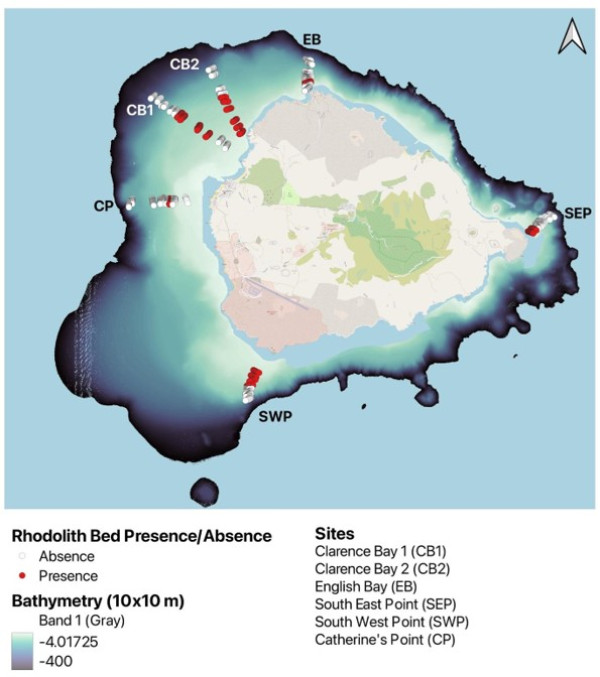
Figure 3. Distribution of mapped rhodolith beds identified during the Mesophotic Project.
Supporting Future Management
The habitat maps and associated biological datasets generated through this project will directly inform implementation of the Ascension Island MPA Management Plan. The data will support future monitoring programmes, improve understanding of species-habitat relationships and help identify areas of particular ecological importance. Importantly, these outputs establish the foundation for long-term, locally led monitoring of mesophotic ecosystems, ensuring that Ascension can continue to track changes in these habitats well into the future.
Community Outreach and Education
Engaging the Ascension Island community has been an important component of the Mesophotic Project, helping to share discoveries from the island’s deeper marine environments and inspire the next generation of marine conservationists.
Showcasing the Deep Sea at the Marine Festival
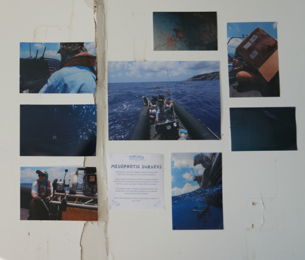
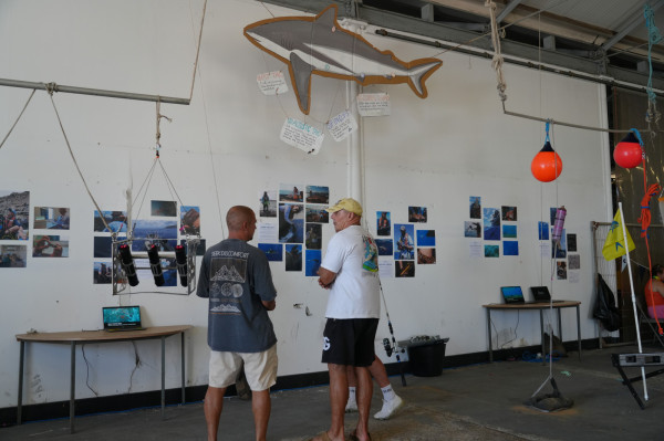
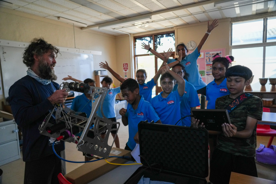
The project was featured at the Ascension Island Marine Festival in both 2025 and 2026. Visitors had the opportunity to see the mesophotic drop camera system used during the surveys and learn how scientists explore habitats hundreds of meters below the ocean surface.
Alongside the equipment display, the project team presented highlight footage captured during surveys, revealing rarely seen deep-water habitats and species from around Ascension Island. A series of species fact sheets introduced visitors to some of the remarkable organisms recorded during the project, including corals, fishes, echinoderms and other deep-sea fauna.
These displays provided a unique opportunity for the community to engage directly with the science behind the project and to discover more about the hidden ecosystems within Ascension’s Marine Protected Area.
Inspiring Young Ocean Explorers
The project also worked closely with the MPA Youth Committee to deliver an educational session at Two Boats School. During the session, students were introduced to the diverse range of habitats and fascinating deep-sea species discovered during the project. You can see the Highlight reel we made for them using the following link to our YouTube channel: Mesophotic Project Highlight Reel
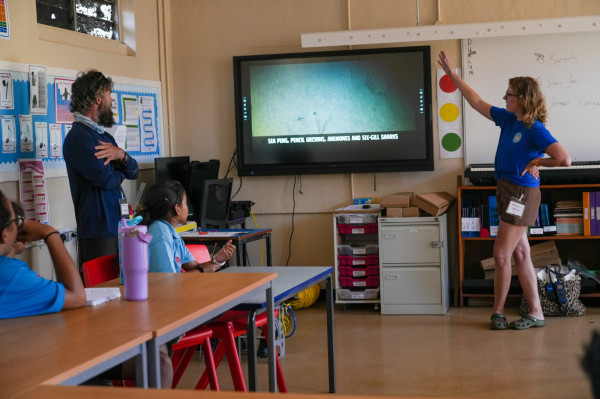
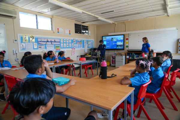
As part of a hands-on citizen science activity, students helped researchers annotate underwater imagery by identifying and recording the species observed in survey footage. This activity gave students a real insight into how marine scientists analyse survey data and highlighted the important role that citizen science can play in supporting marine research and conservation.

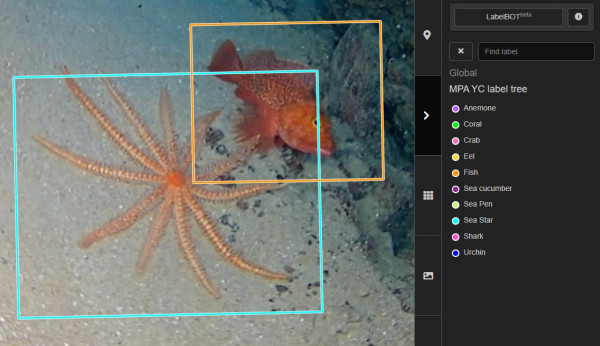

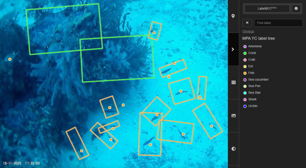
By involving young people directly in the scientific process, the project has helped foster a greater understanding and appreciation of Ascension’s unique marine biodiversity and the importance of protecting these ecosystems for future generations.
If you want to learn more check out our Mesophotic Zone Fact Sheets for some fun facts about our deep sea marine life!